

Arizona Continuously Operating Reference Station Network - AZCORS
The National Oceanic Atmospheric Administration (NGS) Continuously Operating Reference Stations (CORS) Network (NCN), managed by NOAA/National Geodetic Survey, provide Global Navigation Satellite System (GNSS) data, supporting three-dimensional positioning, and geophysical applications throughout the United States. The CORS network is a multi-purpose, multi-agency cooperative endeavor. Surveyors, GIS users, engineers, scientists, and other people who collect GPS/GNSS data can use NCN data to align their work within the National Spatial Reference System (NSRS). NCN enhanced post-processed coordinate accuracies can approach a few centimeters, both horizontally and vertically.
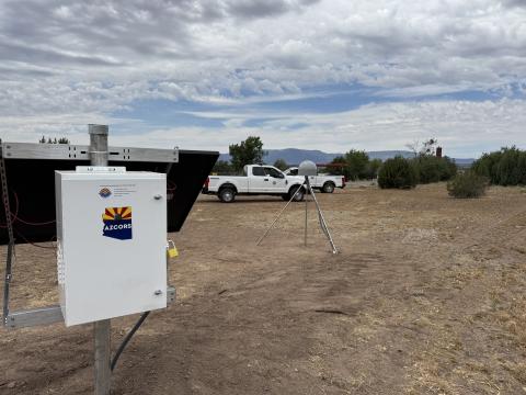
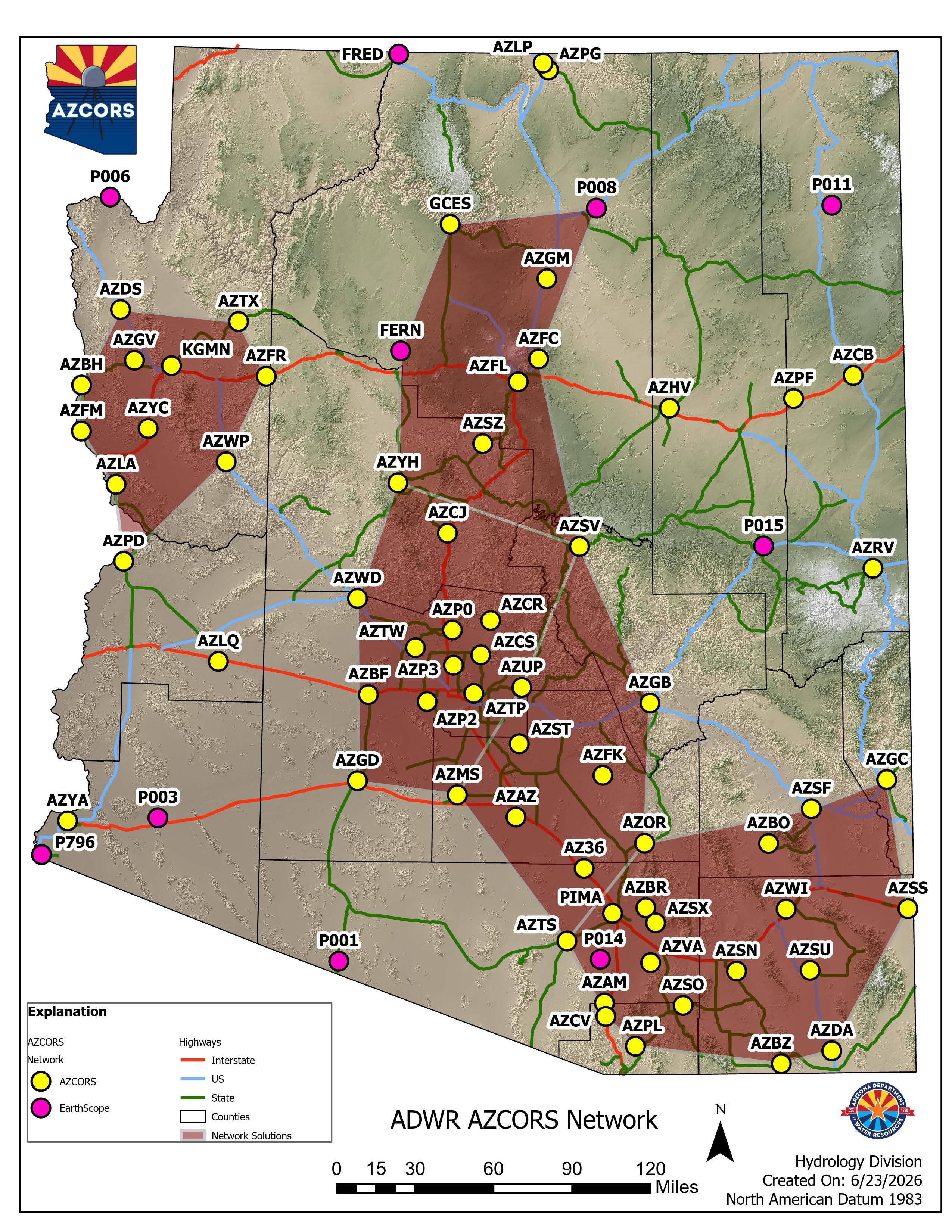
ADWR manages and operates the Arizona CORS Network (AZCORS). AZCORS consists of 63 - State-managed CORS sites and 10 - CORS sites managed and operated by the EarthScope CORS Network in Arizona, for a total of 73 CORS sites. ADWR operates and maintains two virtual servers and software to operate the AZCORS network and distribute the data to other Federal, State, County, and Local agencies, commercial and private entities, and the public. Each CORS station consists of a mounting pole, a GNSS receiver, a GNSS antenna, a cellular router, and associated electronics.
The CORS sites provide high-precision survey data and is the backbone of the geodetic network for Arizona that is used by Federal, State, County, and Local agencies, commercial and private entities, and the public. This data is used for any type of program, project, and/or application that requires accurate horizontal and vertical data such as surveying, mapping, infrastructure, and emergency response projects.
51 of the 63 AZCORS sites managed by ADWR are part of the NGS National CORS Network (NCN) and use the published NGS datasheet coordinates, NAD 83(2011) EPOCH - 2010.00 and the other 12 AZCORS sites were processed using the NAD 83(2011) EPOCH - 2010.00 coordinates from the surrounding CORS sites.
The 10 EarthScope CORS sites that are ingested into the AZCORS network and distributed on the NTRIP RTK datastream also use NAD 83(2011) EPOCH - 2010.00 coordinates.
The 9 EarthScope CORS sites that are part of the NCN use the published NGS datasheet coordinates and the other 1 EarthScope CORS site that is not part of the NCN uses NAD 83(2011) EPOCH - 2010.00 coordinates that are computed by ADWR at least twice a year using OPUS and OPUS-Projects. The vertical datum for all CORS sites is NAVD88.
If you have questions about the AZCORS Network, please email: [email protected]
How to register for AZCORS, network map, and list of mountpoints (REV:2026/06/30).