

Weekly Map - Drought Conditions

The Arizona Drought Monitoring Technical Committee confers weekly to advise the U.S. Drought Monitor authors on the current drought conditions in Arizona, and makes recommendations about the position of the drought boundaries for Arizona. The U.S. Drought Monitor is the official record of drought for Federal drought relief claims. Information used by the MTC in advising the Drought Monitor authors includes numerous drought indices, precipitation and stream flow data, and impacts data. Every Thursday, the Drought Status web page automatically updates with the latest U.S. Drought Monitor map of Arizona.
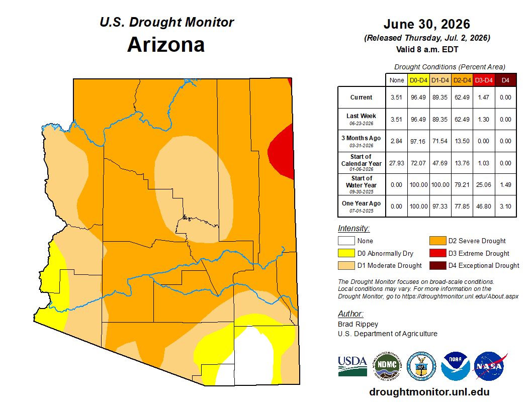
Short-term Drought Conditions
Monthly Drought Status Summary: June 2026
Although June is statistically the driest month for Arizona, a couple of weather disturbances brought above average precipitation to southern locations, including Sierra Vista (1.11 inches; average is 0.54 inches), Tucson (1.05 inches; average is 0.23 inches), and Green Valley (0.47 inches; average is 0.44 inches). Much above average temperatures were recorded across most of the state, leading Arizona to experience its 7th hottest June on record.
Short-term drought conditions were maintained across much of the state. Southeastern and southwestern counties continued with Abnormally Dry (D0) or without short-term drought (11% of state), while Moderate (D1) short-term drought persisted in western and southern counties along with Coconino, Navajo, Gila, and Yavapai counties (27% of state). Extreme (D3) short-term drought decreased in northern Apache County (1% of state) and was replaced by Severe (D2) short-term drought (61% of state).
El Nino conditions have developed in the central Pacific and will intensify into a very strong event. As a result, above average precipitation is favored across the state the remainder of the year.
Long-term Drought Conditions
Quarterly Drought Status Update: April - June 2026
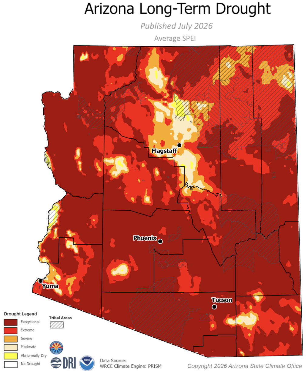
Arizona saw its 6th hottest and 37th driest April to June on record this year in addition to its 2nd hottest and 20th driest past 4 years on record (July 2022 to June 2026). Exceptional (D4) and Extreme (D3) long-term drought was found in every county. Severe (D2) long-term drought was recorded in Coconino, Navajo, and Apache counties and in small areas of Yavapai, Cochise, Maricopa, and Yuma counties. Moderate (D1) long-term drought was measured largely in Coconino County and in small portions of Navajo, Apache, Pima, Cochise, Maricopa, Yavapai, and Yuma counties.