

Maps and Data Downloads
|
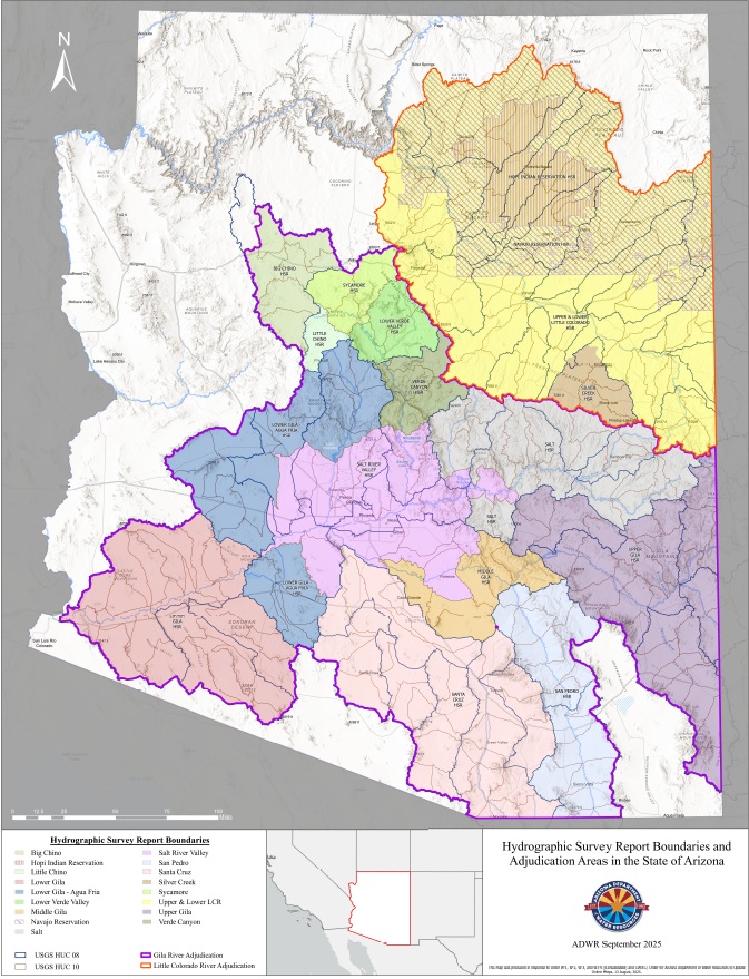
Hydrographic Survey Report Boundaries and Adjudication Areas in the State of Arizona pursuant to the Order for Arizona Department of Water Resources to Update Online Maps. |
|
| Hydrologic Reference for the Adjudications pursuant to the Order for Arizona Department of Water Resources to Update Online Maps. | 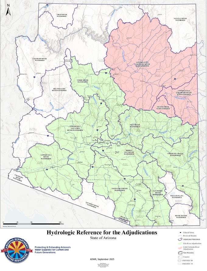 |
|
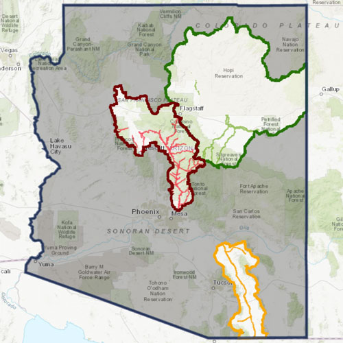
Map of Historical Hydrographic Survey Area Boundaries: As recommended by the Special Master in her Report from March 25, 2024. |
|
|
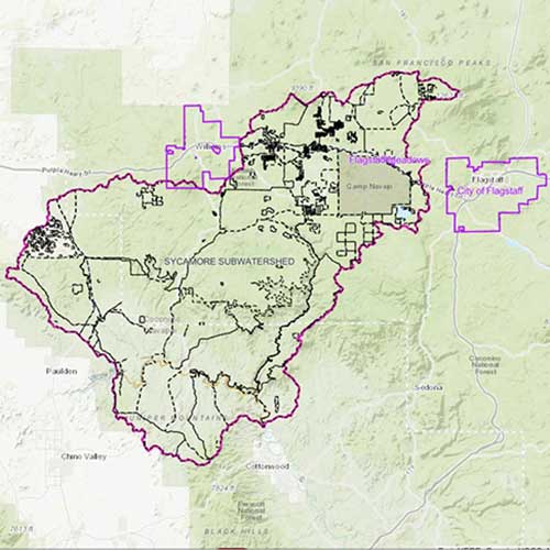
Verde River Watershed Map: This map focuses on the Verde River Watershed and shows the five HSR boundaries within the main watershed. |
|
|
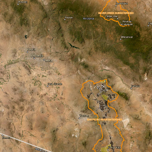
San Pedro River Watershed Map: This map focuses on the San Pedro River Watershed and shows the five subwatersheds within the main watershed. |
 |


Interactive Maps
Data Downloads
The following datasets are intended for GIS professionals and require specific GIS software platforms.
2025 PROPOSED Subflow Zone Delineation for the Lower Little Colorado River Subwatershed Data
2025 PROPOSED Subflow Zone Delineation for the Lower Little Colorado River Subwatershed.
2025 Proposed Verde Subflow Addendum
2025 ADDENDUM Subflow Zone Delineation for the remainder of the Verde River Watershed.
2023 Verde Subflow Zone Data
2023 PROPOSED Subflow Zone Delineation for the remainder of the Verde River Watershed.
2021 Verde Subflow Zone Data
2021 PROPOSED Subflow Zone Delineation for Verde River Mainstem and Sycamore Canyon Subwatershed.
2017 San Pedro Subflow Zone Data
2017 APPROVED Subflow Zone Delineation for San Pedro River Watershed
Hydrographic Survey Report Boundaries
Hydrographic Survey Report Boundaries in the State of Arizona: Pursuant to the Decision Concerning the Special Master's March 25, 2024, Report filed on February 18, 2025